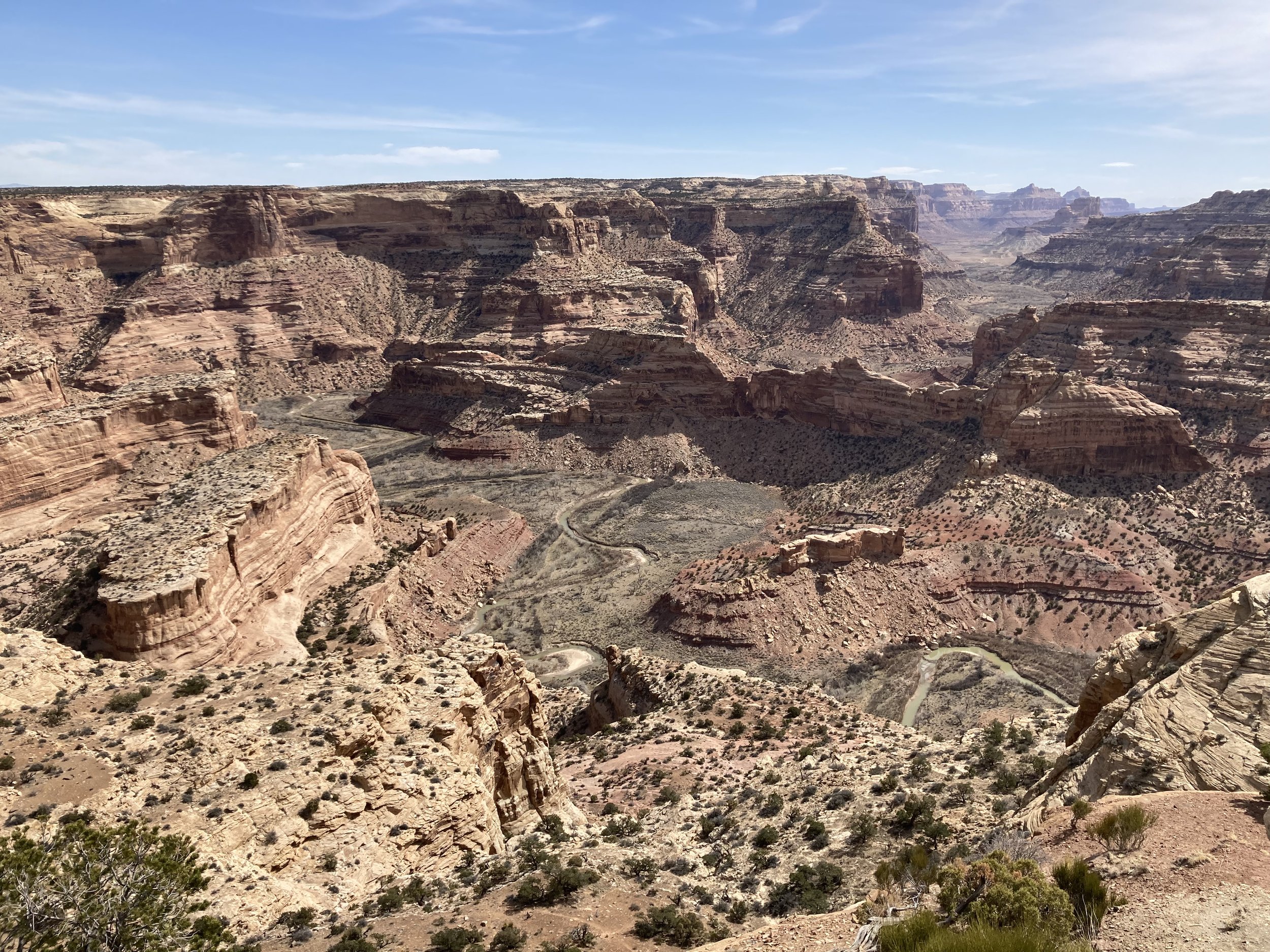
Take A Hike In Utah's Little Grand Canyon — The Wedge
Feeling adventuresome and tired of highly treaded trails? Then it’s time to explore The Wedge area, also known as Utah’s Little Grand Canyon. Immense and remote but easy to get to, The Wedge is a dream for those looking for sweeping canyon views and hikes off the beaten path.
Photos by Melanie Wiseman
This epic destination is located in northern San Rafael Swell just 16 miles west of Green River. Created by accordion-like pressure underneath the earth’s surface, the Swell is a dramatic display of striking rock formations, valleys, canyons, gorges, mesas, buttes and badlands in a kaleidoscope of colors. It spans over 75 by 40 miles.
Before introducing The Wedge, I would be amiss not to mention other great hikes in the area. Begin by taking exit 131 of I-70, heading north through Cottonwood Draw, on Buckhorn Draw Road. You’ll be sandwiched by rolling desert scape, with the lure of the Swell formations straight ahead in the distance.
As you close in on the Swell, crossing the San Rafael River is a refreshing site and your first hiking opportunity. Little Grand Canyon Trail can be accessed near a nondescript BLM sign on the north side of the river. Flat and easy, the trail follows the San Rafael River in the bottom of The Wedge. It is fairly unmaintained, however, and you’ll encounter tall reeds and grasses and the workings of beavers. Round trips of 4.5 to 6.5 miles are filled with stunning, incomparable views of colorful cliff heights.
Red Canyon (West and East Forks) make you work harder for your rewards, which are plentiful. Just after crossing the San Rafael Bridge, turn right on San Rafael Road, pass through the campground and continue on approximately 4 miles to the trailhead on the left side of the road. Known as a canyoneering loop hike, hike the 1.5 miles to the fork, then do each fork separately for a more doable venture. The West Fork is a challenging scramble over large boulders in a narrow, towering canyon. The East Fork is a sandy wash climbing gradually in a wider canyon filled with breathtaking pinnacles, ledges and chutes.
Farther down San Rafael Road and disguised by the desert, Black Box Canyon is a gorge cut by the San Rafael River that deepens as you travel east. A simple dirt pull off is your invitation to traverse 10 minutes across the desert to a point where the gorge begins and allows for a fun scramble to the river’s edge. Drive a couple more miles, and stop where the road condition changes dramatically from two-wheel drive to rugged four-wheel. Once again, take the short hike to the gorge, which is now deep, dark and dramatic, hiking along the rim to various overlooks.
Back at your car, straight ahead is Mexican Mountain, where a 17.5-mile loop hike is located, for experienced hikers only.
If you have time to explore only one area of the San Rafael Swell, let it be The Wedge. After crossing the San Rafael River, continue north on Buckhorn Draw Road. You’ll encounter one of the most visited attractions in the area, the Buckhorn Wash Pictograph Panel. Continue on to the Wedge Cut Off Road until it dead ends at primitive camping along the canyon rim. Sweeping views with resounding similarities to the Grand Canyon and a bird’s-eye view of the San Rafael River as it winds through the 14-mile-long Little Grand Canyon are jaw-dropping.
There are no designated hiking trails on the rim, so explore on your own terms, following the dirt road to the east and west of the marked overlook point.
A FEW NOTES
Prepare for a remote experience. No water is available, so bring plenty. Plan on packing out your trash. Shade is scarce so lather up or cover up, and visit The Wedge area in the spring or fall. Plenty of primitive and dispersed camping is available, giving you time to explore leisurely. Pack a Utah Gazetteer, San Rafael Swell map or use a reliable phone app like All Trails.
Originally published in the Spring 2024 issue of Spoke+Blossom.


